Lower Chesapeake Bay

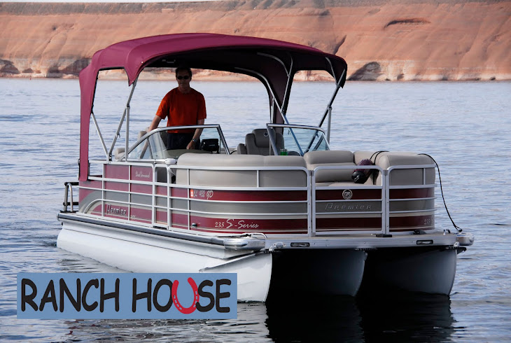
Wouldn't you love to see "Ranch House" next to this?

Naval vessels

Big bridge over the Chesapeake
Thursday from Norfolk, VA to Solomons Island can be described as either the worst day of my trip or the most challenging - both would qualify. From Great Bridge through Norfolk Harbor the "no wake" speed travel was interesting with the Navy ships and maritime industries passing by on both sides. High security was present around the Naval boats with police and Navy patrol boats visible. Then, as I moved out of the harbor to head north on the lower Chesapeake the wind picked up and the water became a little rough, dropping my speed to 15-20 - a preamble perhaps of things to come. I had checked wind and weather the night before and the weather channel that morning before I left. To summarize, the day began at 8:00 and ended at 5:30. It was non-stop on the boat and constant pounding made reading the 7 inch GPS screen difficult – the distance of 110 miles should have been completed by 1 or 2:00.
As I began to cross the mouth of the Potomac River things got worse but there were no marinas close by. I reasoned that given the distance (fetch) from which the wind was coming down the Potomac, I might just as well proceed across the 20-or-so miles to the other side. It couldn't get any worse and should get better. It was grim with salt water at times spraying over me and the boat, and coming under the front gate down the isle of the boat. I was having to position the boat to accommodate the waves and prevent damage.
I finally arrived Solomon at 5:30, not in the mood for poor service at the marina and motel. A man at the marina informed me that there had been a small craft warning out since morning! I had checked weather but neglected to check NOAA marine weather where the warning was posted about the time I left Norfolk. So, a 110-mile trip under small craft advisory and blue skies overhead. Another lesson learned.
Today, Friday, was much more pleasant as I continued up the Chesapeake towards Annapolis and the bridge that crosses the Chesapeake. For the first two hours my northerly and easterly horizon was water only, land visible several miles to my port side. My GPS provided a straight navigation line until finally the bridge came into view about 10 miles away. While I was cruising along I suddenly noticed off to my starboard side an eagle with about an 8-inch fish in its talons - he flew with me for several hundred yards at about 25 mph - perhaps he was showing off.
Once again the vast waters of the eastern U.S. continue to amaze me. After the bridge, the Chesapeake continues to narrow where finally it provides a route to the C & D Canal, and Philadelphia and Washington. This canal links the Chesapeake to the upper Delaware Bay. Tomorrow I travel the 70 miles down the Delaware to Cape May, N.J. Winds? Well so far no warnings but I'm still a small boat in big waters. Look forward to the Hudson and Erie Canal. The Premier pontoon boat is holding up quite well - a "not your grandfather's pontoon" but a boat for serious water. I continue to get positive comments and questions about the "tri-toon" boat. The boat and Yamaha motor continue to give me confidence - completion of the trip will tell.


Traveling against salt water sprays and pounding waves up the Chesapeake, across the Potomac, alongside navy ships sounds like an incredible day, espeically in lieu of the "small craft advisory." Bravo! Soon you'll be on the Hudson and in New York Harbor.
ReplyDeleteYou be careful out there! Cooper spent the night at Joanne's- he loves his fairy godmother. -Tina
ReplyDeleteI am keeping up with you Lyn. I love the Chesapeake. So diverse.
ReplyDeleteStay safe. Looking forward to your next posting. God's speed. Kathi
Gave me goose bumps reading about your extremely grueling day. You must be a good captain with a good boat. It's warming here in Colorado.
ReplyDeleteRita