Friday, June 18, 2010

Lower Chesapeake Bay

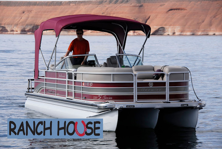
Wouldn't you love to see "Ranch House" next to this?

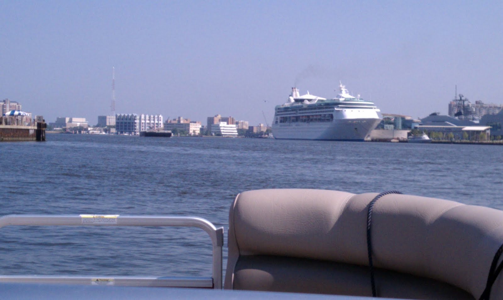
Naval vessels

Big bridge over the Chesapeake

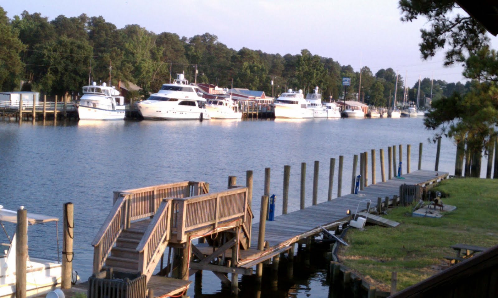
Sailboats and homes along the Chesapeake

Thursday from Norfolk, VA to Solomons Island can be described as either the worst day of my trip or the most challenging - both would qualify. From Great Bridge through Norfolk Harbor the "no wake" speed travel was interesting with the Navy ships and maritime industries passing by on both sides. High security was present around the Naval boats with police and Navy patrol boats visible. Then, as I moved out of the harbor to head north on the lower Chesapeake the wind picked up and the water became a little rough, dropping my speed to 15-20 - a preamble perhaps of things to come. I had checked wind and weather the night before and the weather channel that morning before I left. To summarize, the day began at 8:00 and ended at 5:30. It was non-stop on the boat and constant pounding made reading the 7 inch GPS screen difficult – the distance of 110 miles should have been completed by 1 or 2:00.

As I began to cross the mouth of the Potomac River things got worse but there were no marinas close by. I reasoned that given the distance (fetch) from which the wind was coming down the Potomac, I might just as well proceed across the 20-or-so miles to the other side. It couldn't get any worse and should get better. It was grim with salt water at times spraying over me and the boat, and coming under the front gate down the isle of the boat. I was having to position the boat to accommodate the waves and prevent damage.

I finally arrived Solomon at 5:30, not in the mood for poor service at the marina and motel. A man at the marina informed me that there had been a small craft warning out since morning! I had checked weather but neglected to check NOAA marine weather where the warning was posted about the time I left Norfolk. So, a 110-mile trip under small craft advisory and blue skies overhead. Another lesson learned.

Today, Friday, was much more pleasant as I continued up the Chesapeake towards Annapolis and the bridge that crosses the Chesapeake. For the first two hours my northerly and easterly horizon was water only, land visible several miles to my port side. My GPS provided a straight navigation line until finally the bridge came into view about 10 miles away. While I was cruising along I suddenly noticed off to my starboard side an eagle with about an 8-inch fish in its talons - he flew with me for several hundred yards at about 25 mph - perhaps he was showing off.

Once again the vast waters of the eastern U.S. continue to amaze me. After the bridge, the Chesapeake continues to narrow where finally it provides a route to the C & D Canal, and Philadelphia and Washington. This canal links the Chesapeake to the upper Delaware Bay. Tomorrow I travel the 70 miles down the Delaware to Cape May, N.J. Winds? Well so far no warnings but I'm still a small boat in big waters. Look forward to the Hudson and Erie Canal. The Premier pontoon boat is holding up quite well - a "not your grandfather's pontoon" but a boat for serious water. I continue to get positive comments and questions about the "tri-toon" boat. The boat and Yamaha motor continue to give me confidence - completion of the trip will tell.


Wednesday, June 16, 2010

Took a weather day today as there were thunderstorms early this morning that I thought would rebuild early in the afternoon. However, it cleared off and I actually could have traveled north before that happened. Caught up on my journal and walked for some exercise. Storms again this evening in the area so hope they clear by morning. The trend into next week is for fewer thunderstorms but remaining hot. Plan to go to Solomons tomorrow - it is a fishing village north of the Potomac River at the mouth of the Patuxent River on the west side of Chesapeake Bay about 100 miles north of Norfolk. Concern after tomorrow is lodging availability due to Father's Day weekend. I'm missing a guide book that I'll pick up tomorrow that will give me information about marinas and phone numbers all the way north to the Erie Canal

Tuesday, June 15, 2010

Navigational aid with eagle's nest on top - parent off in search of breakfast.

Boat belonging to folks from Nova Scotia with whom I had dinner yesterday.

Boats in Coinjock

From Coinjock to Chesapeake today, just south of Norfolk and Portsmouth VA. The navigation aids used through most of the waterways are a red triangle or a green square. The color indicates on which side of the marker you should pass depending on whether you are going north or south or into a port. These are placed on a single wood piling in the water with the aid rising 5 feet or more off the water. As most of the waters are under 20 feet in depth the piling can be set and insure visibility from longer distances - sometimes I have to use my GPS and fix on a navigation aid I can’t see but must pass. So I put the cursor on that and then use the function "GO TO" until I can see the marker. The aids are important as they show the general channel. The aids are not frequent enough that you can go flying down a waterway without paying attention - sooner or later you will go aground and that can be very expensive. I've done this several times and was able to push the boat off the shoal and continue on - nicked up my prop but not game ending. I do carry a spare prop and, after my mishaps, try to pay more attention to where the channels go. Some of the biggest bodies of water may have depths of less than 5 feet, even miles from shore.

The thing about the nav aids is that most of them have resident birds resting on them. Today there were permanent eagles’ nests atop almost each pole and you could see the heads of the young eaglets in the nests. Some poles are lighted and are indicated as such on the navigational charts. It is not recommended for recreational boaters to travel at night, but commercial traffic does use the waterways 24 hours.

Got a taxi to my room and the driver showed me where I could find the Verizon store - needed some advice and a new charger. My Verizon Incredible phone sure is nice and I'm still learning features. A direct competitor to the iPhone, it has many features that have come in handy on this trip.

Tomorrow I will attempt to go 100 miles up the Chesapeake to Solomons, MD. Will have to check the weather at 5 when I get up to make sure it is ok to give up my room and take a taxi back to the boat. Sometimes the logistics of this trip can be a little overwhelming but like today, there was a minimum of hassle getting the boat situated and it took only 20 minutes to get to a decent hotel with stores and restaurants nearby. The taxi driver waited at several hotels until I could find one that had a vacancy. Now that school is out and graduation ceremonies occurring "no vacancy" signs are not so rare.


Monday, June 14, 2010

A lot of progress in the past two days, Sunday and Monday. Sunday I traveled from Southport, NC to Oriental, NC; and today from Oriental to Coinjock, NC - both about 135 mile days. Due to starting early I had time both days to walk around the towns a bit in the afternoon. Oriental is called “the sailing capital of NC.” The population is less than 500 but many more boats are kept here in the marinas by people from many locales. The town is beautiful with pine trees and well kept homes - the ones along the Neuse River are particularly scenic.

Sunday I traveled through Moorehead City and Beaufort on the Beaufort Inlet to the Atlantic. Industries include commercial shipping, sport fishing and recreational boating. Camp Lejune Marine base is nearby as well as a naval air station.

Today, Monday, began at 4:30 AM as I planned to cross two of the most dreaded open water crossings on the Loop, the Pamlico and Albermarle Sounds. Depending on wind direction I chose to do both today based on the mild wind forecast. The prediction was off a bit on Neuse River past Oriental when I left this AM with whitecaps building rapidly. After that I crossed the Pamlico River/Sound and it was a moderate chop on to Belhaven which I reached by 8:00 AM. Then it was on to the Alligator/Pongo River and canal. I traveled through a naturalist’s paradise of birds and quiet water lined with Cypress Swamps. There are alligators present and reports of bears seen swimming across the canal. The canal opens up to the Alligator River and the potentially very rough Albermarle Sound. It got breezy half way across the 30 miles but the wave direction quartered my path so the boat took the water in stride maintaining 20-25 mph.

Coinjock is located along a canal - a peaceful village with two marinas. There were some very large 60-65 foot cruisers tied up by 4:00 P.M. I'm in the Midway Marina and Motel, my favorite combination of accommodations. I met a couple from Nova Scotia who are returning north in their sailboat and we had quite a nice discussion. We took their dinghy across the canal to the only restaurant open in town. Tomorrow will go 40 miles north to vicinity of Great Bridge, VA just short of Norfolk, to plan my trip up the Chesapeake and down the Delaware.

Saturday, June 12, 2010

Bridge and glass smooth water above Georgetown SC
One of the few remaining pontoon bridges in the US - this one held everyone up for two hours on Friday!
Eagle in the nest
If there's a Golden in the area, I'll find him.

Today Saturday, rest day. Yesterday traveled 130 miles from Isle of Palms, SC outside Charleston to Southport, NC at the Cape Fear River Inlet. Left at 6:30 AM so should have been in Southport by early afternoon but not to be. One of the few pontoon bridges left on any major waterway could not open for another two-and-a-half hours due to unusually low tide. The heat index was about 98. An assortment of mostly recreational boats, cruisers and sailboats were waiting on both sides. Meanwhile I watched a thunderstorm build in my path. After the bridge opened, and about 10 miles from my destination, I waited for the storm to pass in front of me and finally made Southport by 4:00 - 10 hrs on the water. Taxied to Hampton Inn and ate at a nice Italian restaurant next door.

Tomorrow I'll depart across the Cape Fear River for Oriental, NC on the Neuse River 20 miles north of Beaufort, NC. Hope there are few delays as the heat index will be up again tomorrow - it is 98 here this afternoon. Beaufort is the place on the coastline of the U.S. where you stop going northeast and turn more to the north towards Norfolk, VA and the Chesapeake. At Oriental I will have a room near the marina so no taxi necessary - small pleasures on a trip like this.

Sure is a tragedy in Langely, Arkansas concerning the canyon that flooded overnight killing 18 and many still missing. Reminds me of the Big Thompson flood west of Boulder in 75 or 76 due to a thunderstorm that stayed in place for hours upstream. Mother nature never exactly repeats herself but we should be able to learn some things for future reference. Glad to hear that Abby Sunderland was found safe after her sailboat was found without its mast - hard to imagine 20-40 ft seas.

Speaking of waves, I will cross some pretty big water in the next week or two where the intercoastal links with larger rivers/lakes such as Pamlico Sound, Albermarle Sound, Neuse River, Chesapeake Bay, Delaware River and outside the New Jersey coast for a short distance to New York Harbor. Another reason to start early - wind forecasts for next few days remain light - dog days of summer I hope. An advantage of my boat in these cases is that when conditions are good I can take advantage of its 30-35 mph cruising speed. The big boats are exposed for much longer, often cruising at top speeds of 10 to 20. Not to worry - I have banked a lot of weather days due to good weather up to now so can sit out any unfavorable conditions. My phone is loaded with each day’s route weather and the Weather Channel is my nighttime favorite. So long for now - alarm at 4:30 and taxi to marina at 5:30.

Thursday, June 10, 2010


“The drinking will stop when the economy improves.” The words on a t-shirt worn by a customer at the Isle of Hope Marina south of Savannah. Today traveled from Beaufort, SC to Isle of Palms near Charleston - hard to keep track of all these "Isles.” Rivers, inlets and canals make the way with marshes, many birds and occasional dolphin. Very peaceful country and somewhat remote in places.

After leaving Beaufort this morning got to see Navy/Marine Corps jets from the nearby air stations making approaches - very low and loud and I had a ring-side seat. Yesterday passed by Hilton Head Island - would like to fly over some of the country I'm traveling through as the nautical charts don't show a lot of the inland areas. But a road trip will suffice. Many of the bays, sounds and rivers, when you come upon them from a narrow channel through the marshes, are very big water with at least one of the horizons only the sky. Winds have been low to moderate so waves are not too big - one to two feet as a rule I estimate. This afternoon spent an hour on the Atlantic beach here by the motel. First chance I've had since the intercoastal parallels the ocean sometime only by one barrier island and other times several miles away.

Tomorrow I have a 150-mile day ahead of me to Southport, NC and the cab will pick me up at 0600. As we head into summer, more and more of the hotels are booked for the weekend. I often spend several hours each afternoon/evening calling marinas and motels close by the marinas so that I can be assured of lodging at the end of the next day. This is peace of mind necessary to enjoy that day's trip.

The cabbies often are a great source of local history so I make use of it when going between marinas and hotels. Interesting how one marina, hotel or any business can have the concept of customer service figured out and the next one does not. Can't blame the employees but sure can blame the manager. A subject for another time but I see on a daily basis the businesses that will thrive and those that will not. The chain hotels have the best and most consistent training of staff. Too bad some of the other managers can't attend those training sessions as they don't really know what team leadership requires of them. Enough of that soapbox but it will return.

So long and Happy Father's Day - Ranch House will honor both my parents.
Photos: Top - Isle of Hope Marina; Paris Island Marine Recruit Depot; smaller Hilton Head dock; Charleston Harbor.

Tuesday, June 8, 2010

Ah yes, another test day. Stayed in Fernandina, FL yesterday to dry out gear from the storm; the location was perfect with a fine marina having floating docks and a hotel across the street. So, I planned an early start by 6:30 this morning to do a leisurely trip to near Savannah, GA, about 130 miles.
I take the Lowrance GPS off the boat each night so it will not become the victim of a midnight acquisition. In the morning I plug it in and go. Today, it didn't work. The “black screen of death” - power, but no screen. After half-an-hour of troubleshooting I dug out the hand-held Garmin I had purchased for a back-up, thinking it was probably a waste of money. I inserted the chip for U.S. coastal waterways and got underway. The small screen is no comparison to the Lowrance 7" GPS screen.
I called Lowrance support later in the morning from somewhere on the intercoastal, and after 20 minutes of “hold,” spoke to a tech support person who was not supportive - told me to “mail in the unit and it will take 2-3 weeks.” But, you don't understand . . . . . . . Anyway, I will not purchase Lowrance again.
My boat and Lowrance dealer, Hallberg Marine north of Minneapolis, came through on short notice and arranged the overnight shipping of a new unit which should allow me to get underway from the Isle of Hope Marina here in Savannah, Ga. by 10:00 AM Wednesday. Even Dana from Hallberg Marine hung up after 15 minutes of being on "hold" with Lowrance support. It is such a pleasure to deal with someone who doesn't take no for an answer and finds solutions. Dana got a replacement from his distributor. Thank you Dana from Hallberg Marine.
Some of the Hallberg (dealer) and Premier (manufacturer) folks have been following my trip. This trip should be an engineer’s dream - put the boat to more use in 3 months than anyone would normally do in 10 years and then look for any weaknesses in the product. I continue to get positive comments about the boat.
Clear weather today and I cruised among the waterways that make up the intercoastal going north. Many of these waterways connect to the nearby Atlantic and large shrimper and shipping boats can be encountered. The tidal flow now increases to near 8 feet daily until I get north of South Carolina. This causes significant currents in all the waterways and can expose shoaling areas affecting any boat but mainly the cruiser types that draft 3-5 feet. I draft 2 feet but still can go aground if not careful.
Today I crossed or traveled the Cumberland Sound, Cumberland River, Jekyll Sound, St. Simons Sound, Frederic River, Buttermilk Sound, Sapelo Sound, St. Catherine River/Sound and others. Towns are few, the riverbanks through GA began to show their white sands. If the weather holds tomorrow I may get close to Charleston, SC by afternoon despite a late start.
Saw a little of Savannah this afternoon and will definitely file this historical city for a road trip with Joanne, my wonderful wife! Olive Garden and two margaritas ended the day - not the same without Joanne but nonetheless enjoying seeing this great country from its waterways.
Tomorrow is particularly special as I will pass by Paris Island Marine Corps Recruit Depot near Beaufort, S.C. The intracoastal actually passes through part of the training terrain and boats have been delayed due to U.S.M.C. training maneuvers. Heat, bugs, and mud - and then add a little adversity, could be the motto there. Many of the fine Marines I had the honor to lead as a platoon commander in Viet Nam were trained at Paris Island. Thank you drill instructors of Paris Island for setting the uncompromising standards that allowed many Marines to survive Southeast Asia while serving their country... many continue to serve today. Semper Fi.